On October 21st and 22nd, 2017, I camped in Bureau of Land Management (BLM) Land outside of Canyonlands National Park, and I drove one of the most adventurous & dangerous roads in Utah, unintentionally.
Almost all of what I do when I travel is unintentional, because I don’t do any research, or planning, in advance. On this trip (my epic road trip to visit all of the National Parks) I am living out of my car, and am tent camping as often as possible to save money. I never have a plan for what I am doing tomorrow, or even today, in most cases. This adventure is typical of how my days unfold when I have no plans!
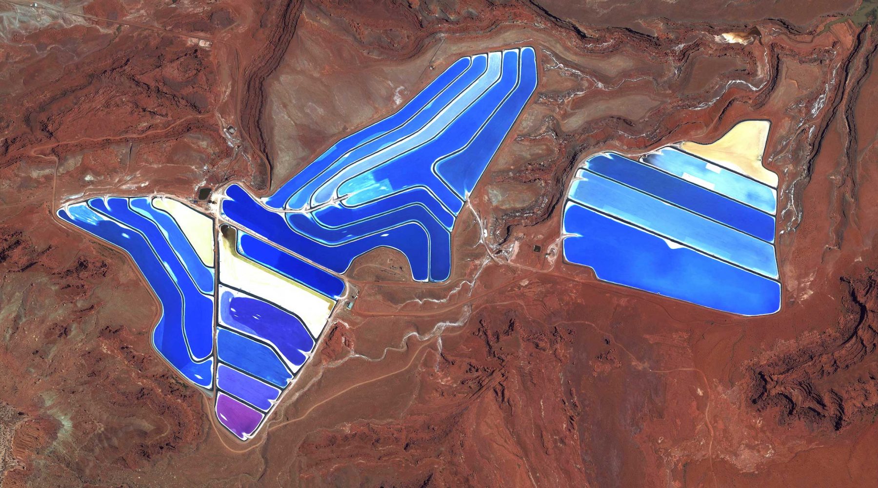
After spending 5 nights camping on BLM land near Arches National Park, I decided to explore some other parts of Moab. I took a look at Google Maps and noticed these huge purple-hued pools way up in the mesas between Canyonlands National Park and the town of Moab. I zoomed in on them and was so curious about seeing them in person that I packed up my car and drove straight to them, not knowing if they were publicly accessible, or what they even were.
I drove from downtown Moab, along the Colorado River, then into the mountains, towards the spot on the map where the pools were located, but the sun was setting quickly, and I had no plan for where to sleep that night. As I made my way up the rough backcountry road towards the pools, I noticed that all of the land was marked as BLM land, so I would be able to camp there. I drove for about 30 minutes up into the mountains as the sun set, but every pull-off that I tried to access already had someone camping on it (it was a Saturday night). I kept driving and driving and finally found a spot to set up camp, albeit after the sun set, which isn’t ideal. I prefer to set up my campsite in daylight so I know my surroundings, and have time to collect firewood and organize my life. I spent 7 hours wide awake, in the dark, trying to fall asleep, and finally was able to sleep around 3AM.
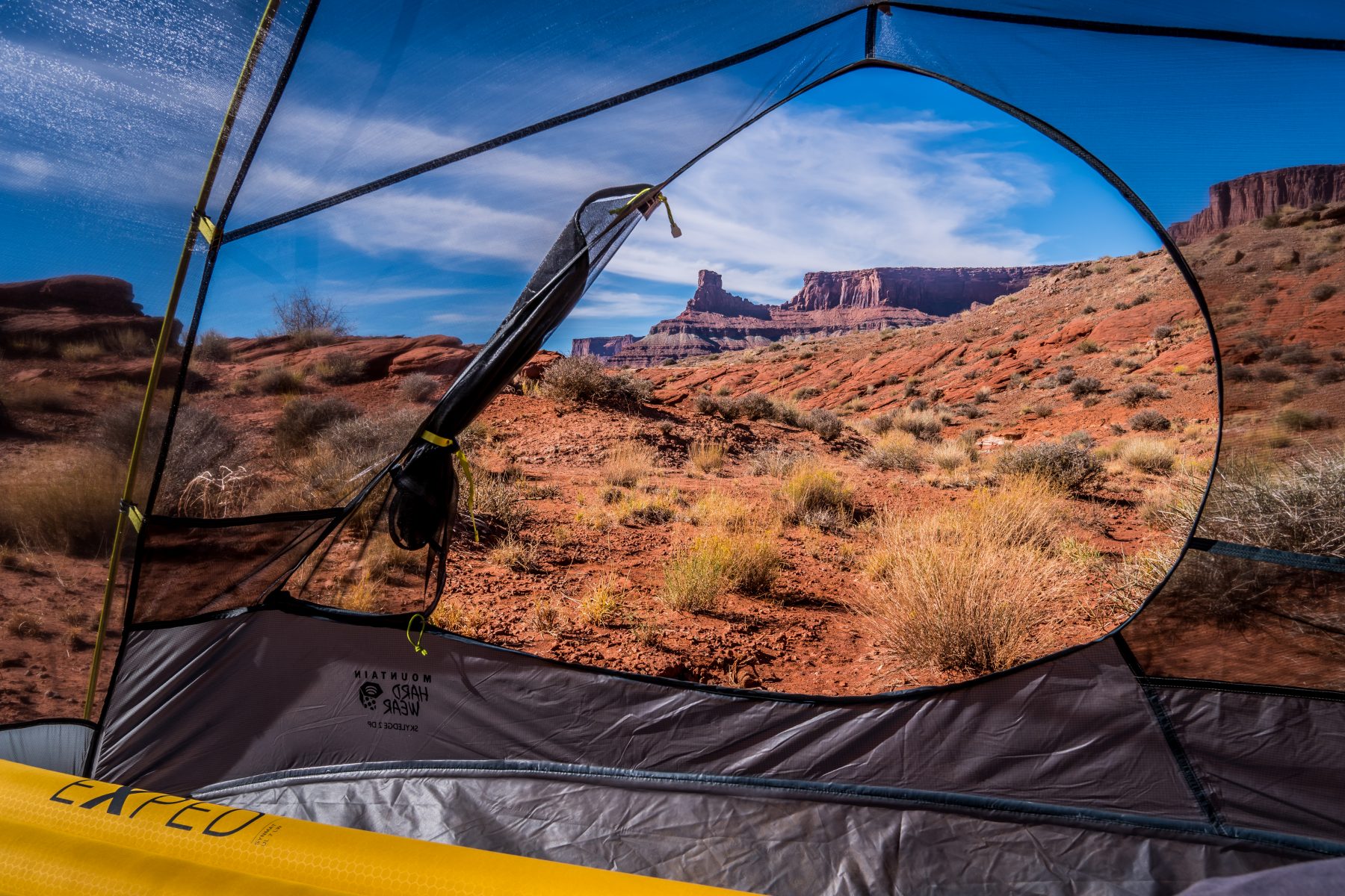

The next morning I woke up to this unbelievable view, but I also woke up to people driving their vehicles right through my campsite. People are supposed to respect other campers by driving slowly and quietly, but these people apparently didn’t care about the unwritten etiquette of dispersed camping. I got up, made a coffee, had breakfast, and broke down my camp. I hopped in the car and continued my quest to see the purple pools.
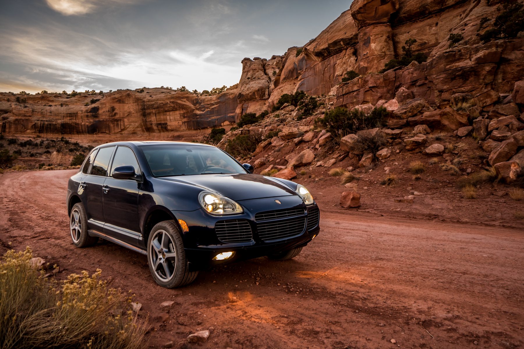
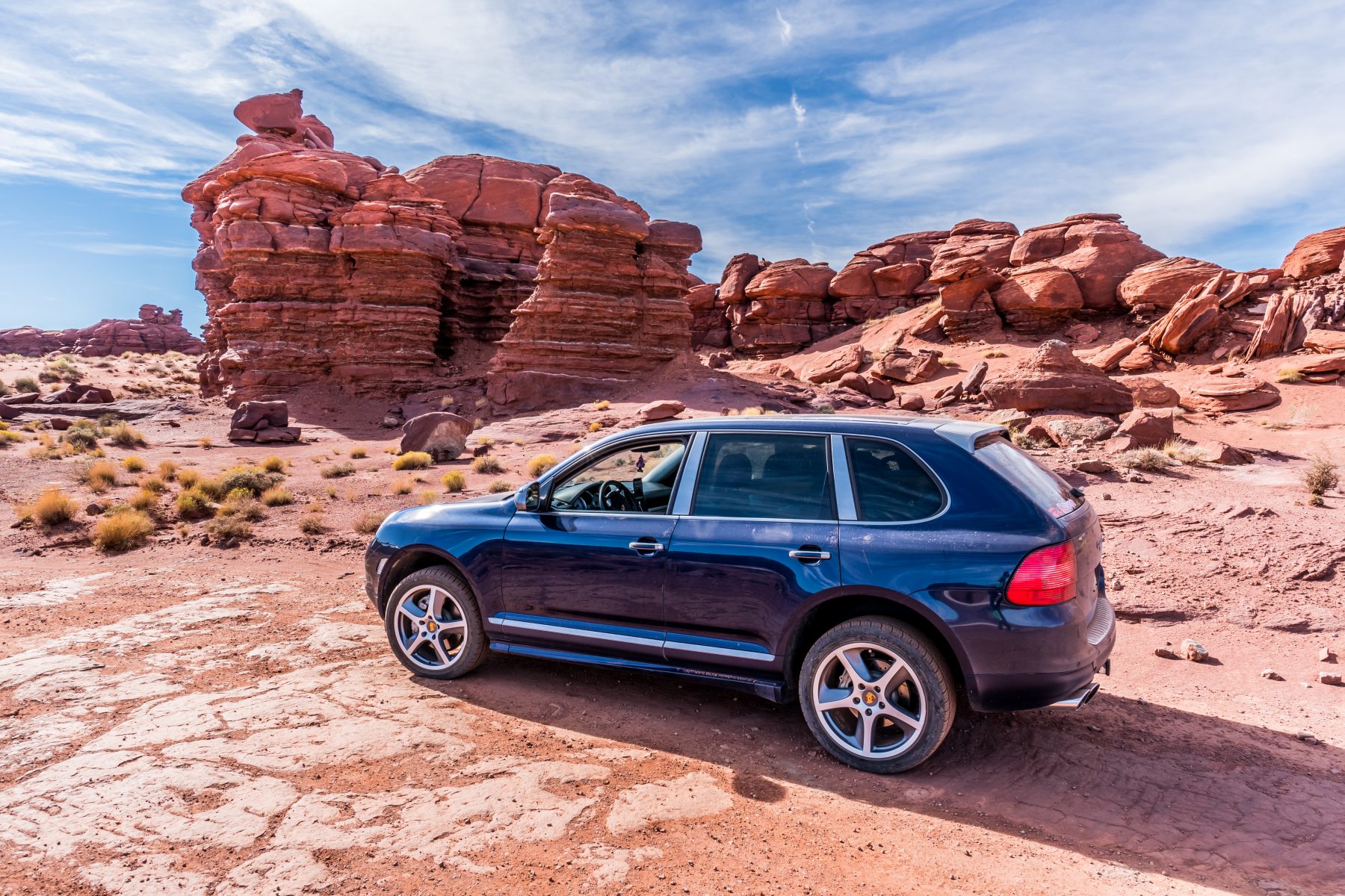
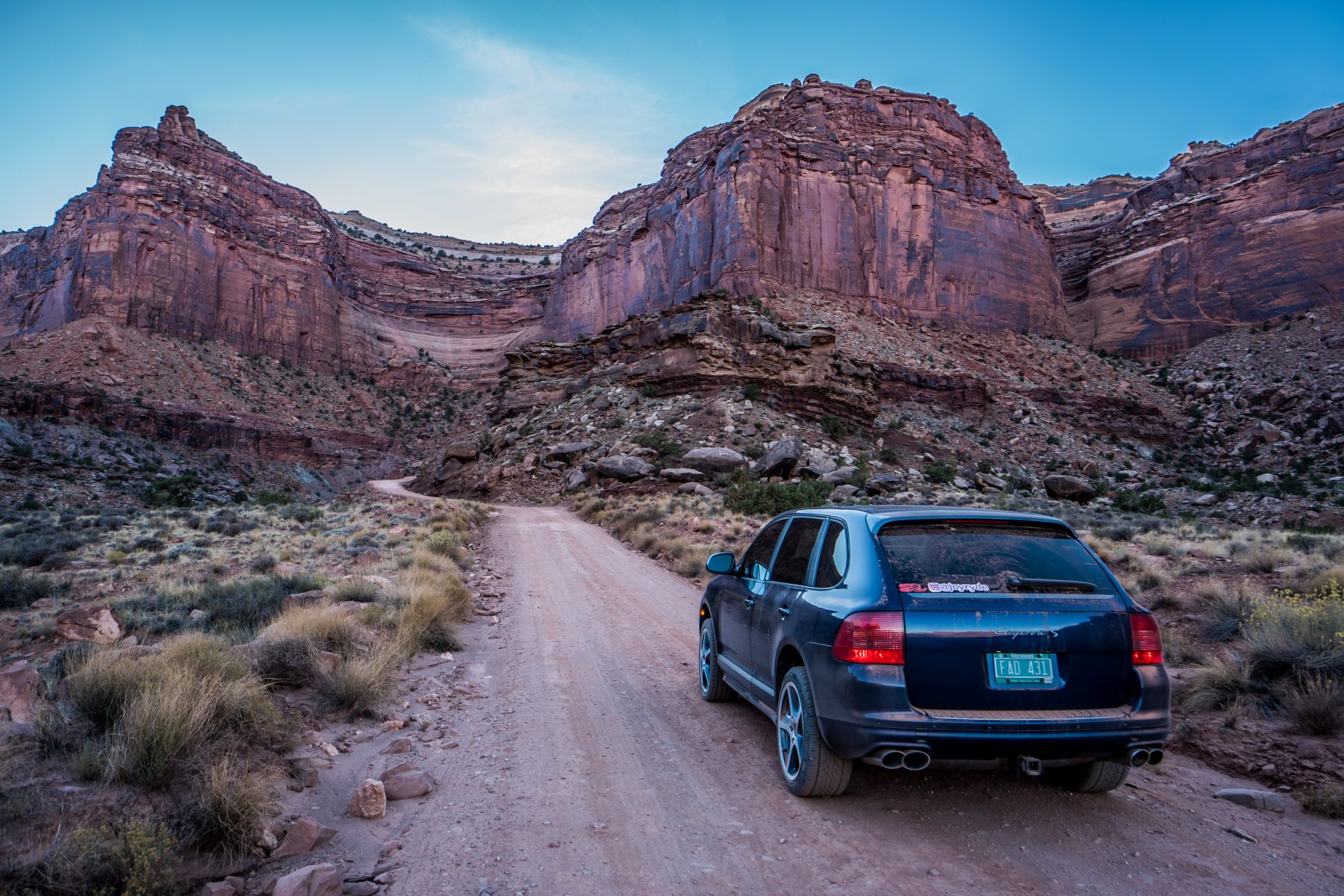
It took me about 30 minutes of driving carefully to finally start to see signs of the facility, and the pools. The road is hardly passable in a car; my SUV, with 9″ of clearance, made it, but I was always on edge about getting stuck or blowing a tire. My car is highly capable of off-roading, but my wheels and tires are hardly ideal for it. I have 20″ wheels with about 2″ of tire on them! I make it work, but it’s really stressful! I passed a woman in a Honda CR-V who didn’t make it up; she had parked and walked the last 2 miles up the road to photograph the pools.
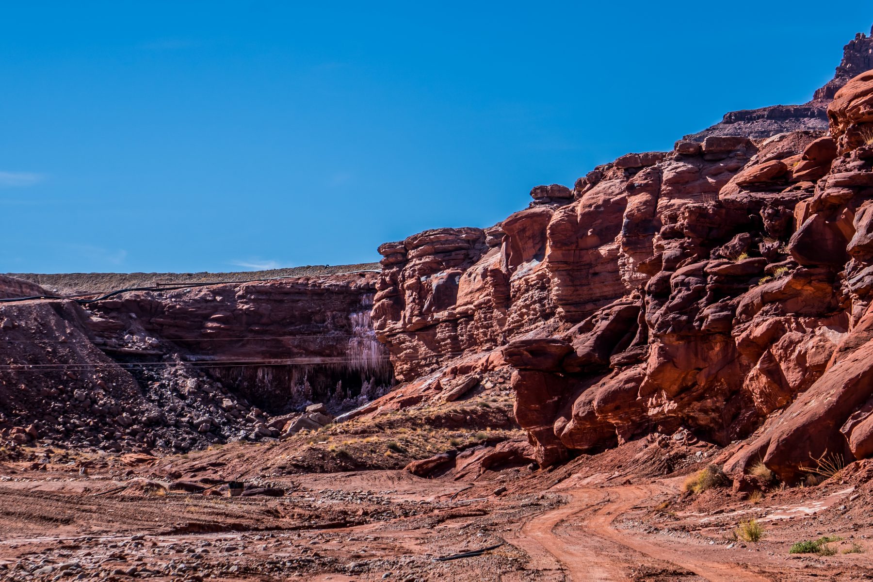
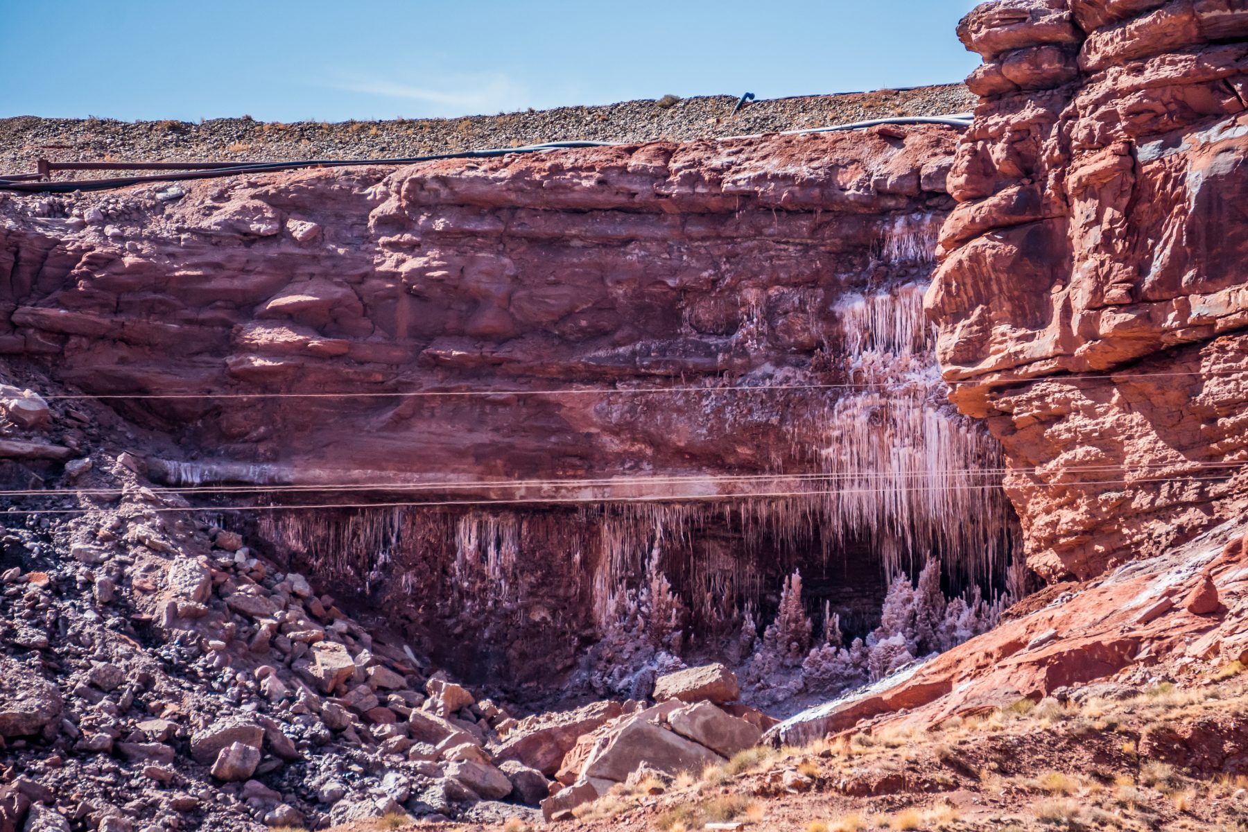
The first thing I saw at the mine was a large cave, with icicles hanging across the opening (which at first seemed odd because it was 70 degrees outside). There were very firm signs posted about not trespassing, so I took the above 2 photos from a distance. I was pretty confused as to what it was, but now that I’ve have researched it, I’ve found out that the cave, the pools, and the facility surrounding them, is the Intrepid Potash Mine. Intrepid is the largest producer of potassium chloride, (also known as muriate of potash), in the United States.
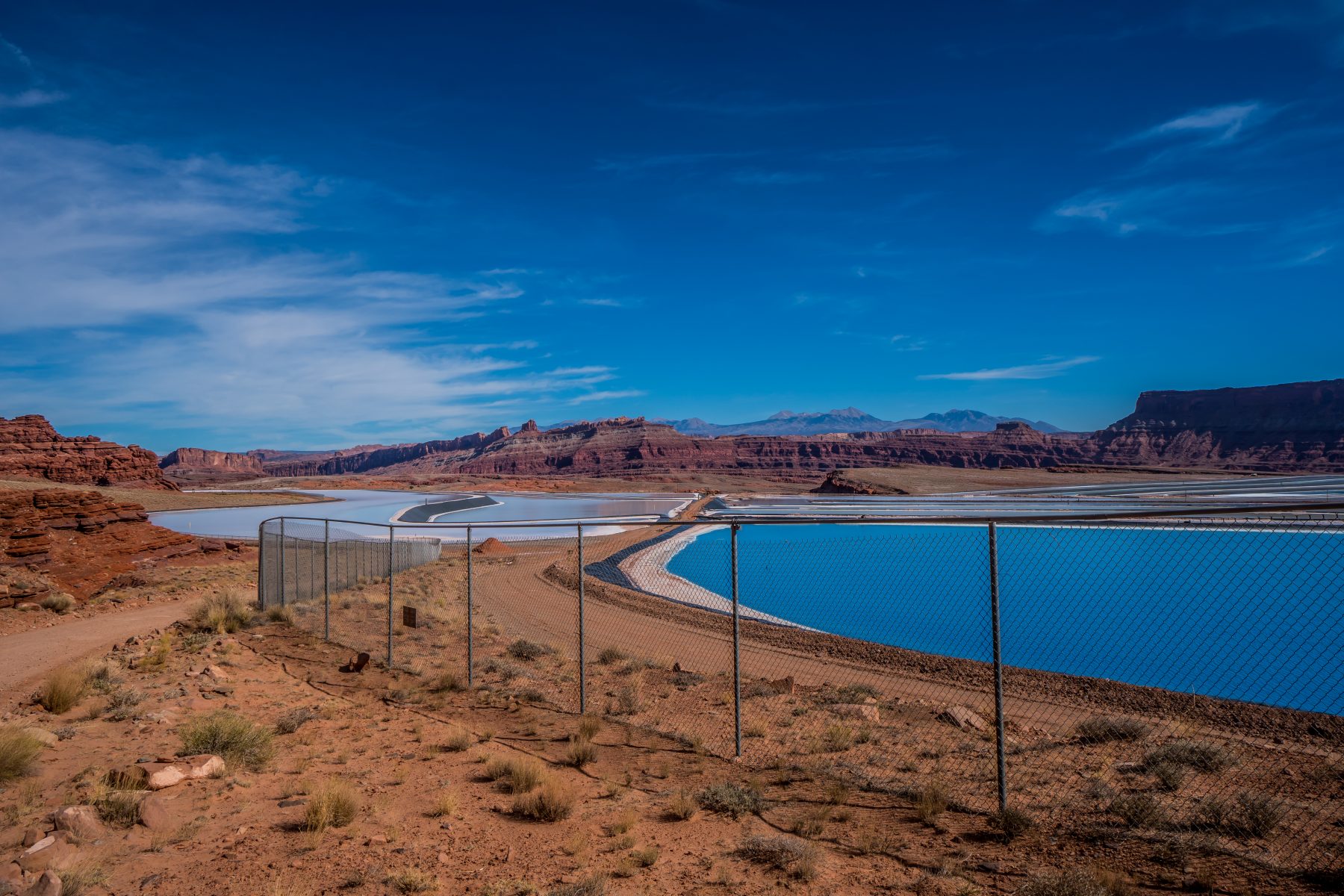
The plant was originally built by the Texas Gulf Sulphur Company in 1963 as a typical underground mine. The same year it opened, a massive gas explosion trapped 25 men underground, killing 18 of them. In 1970 the underground mine was converted to the solution mining system that is still in use today; where humans no longer have to go underground to extract the potash. A solution of salt and water (brine) is pumped into deep injection wells. Brine is used, instead of simply water, to dissolve the potash, leaving other minerals in the rock 4,000 feet underground, undisturbed. Then the brine, now heavy with dissolved potash, is pumped back up into the evaporation pools up on the top of the mesa. The pools themselves are dyed the intense blue color to better absorb heat from the sun. In this hot & dry desert climate, it takes 300 days for the brine to dry into salt and potash crystals. Machines scrape up these crystals from the bottom of these rubber-lined ponds, and they’re sent off for processing.

Most potash forms in very arid regions when inland seas dry out. Most of Colorado and Utah was once a massive sea; and when the seas retreated, they left salt that was up to a MILE thick in some parts of Utah. As the sea water evaporated, it left behind potassium salt deposits. Over geologic time, sediment buries these deposits and they become potash ore. The ore at the Moab site (4,000 feet below the surface) began to form 300 million years ago.
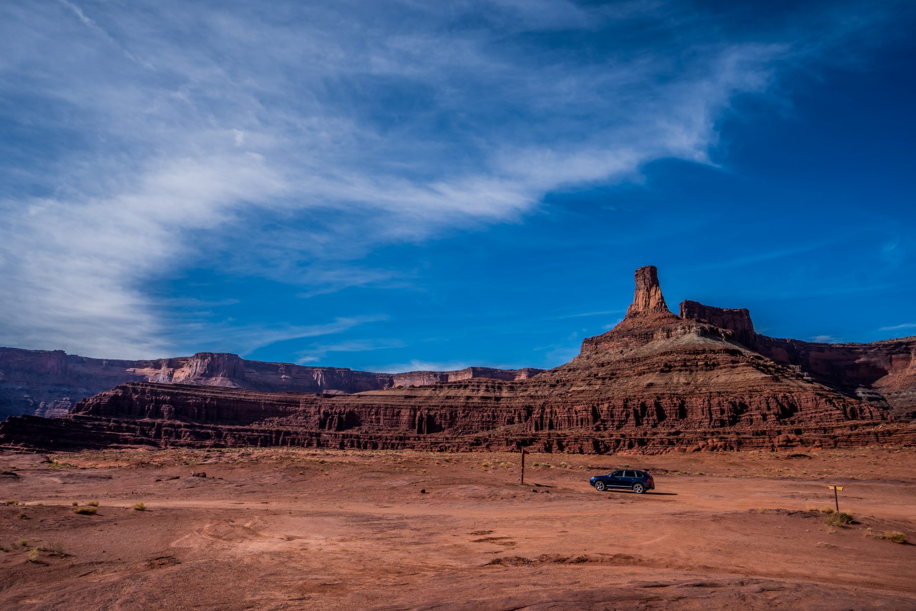
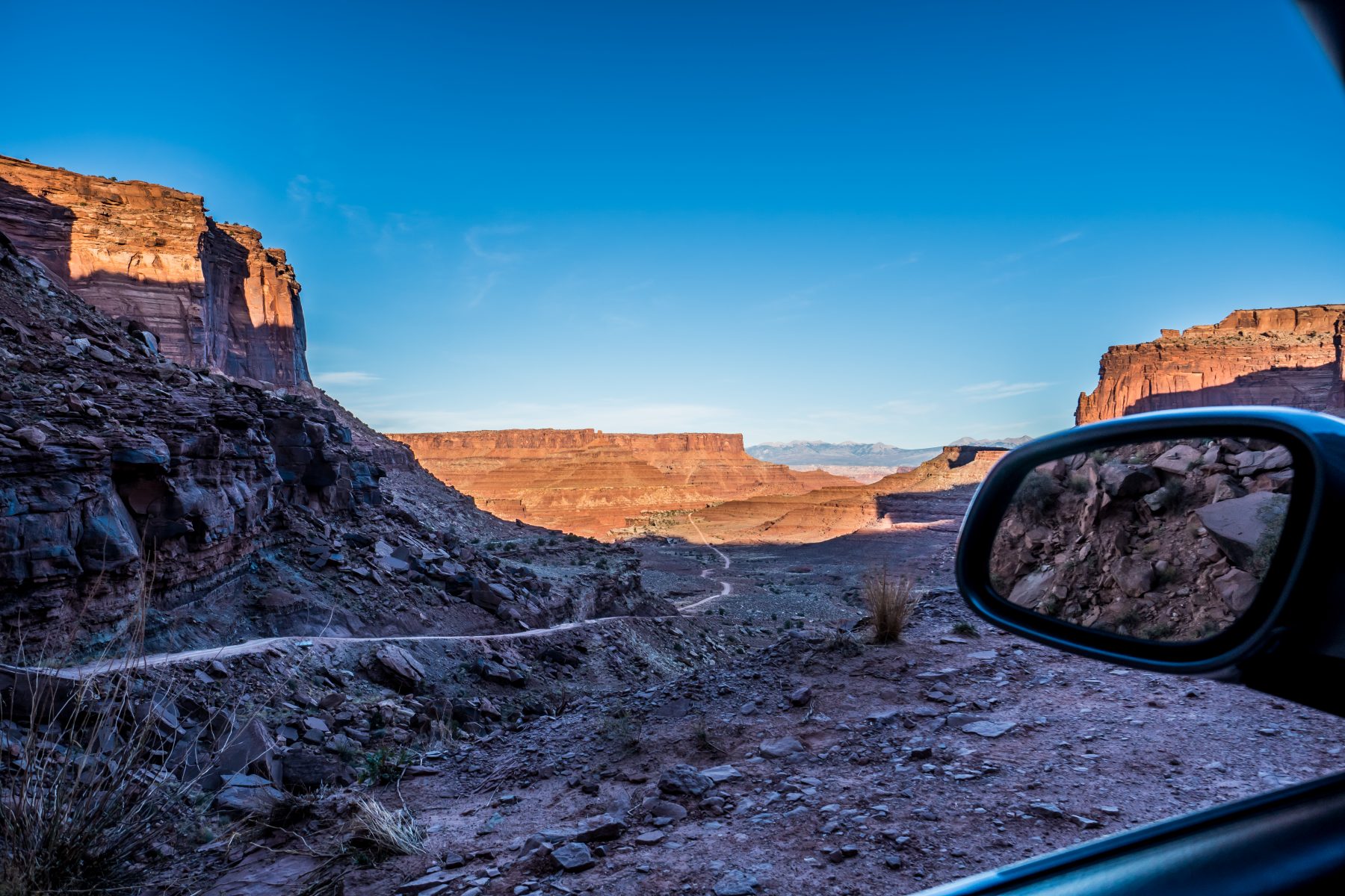
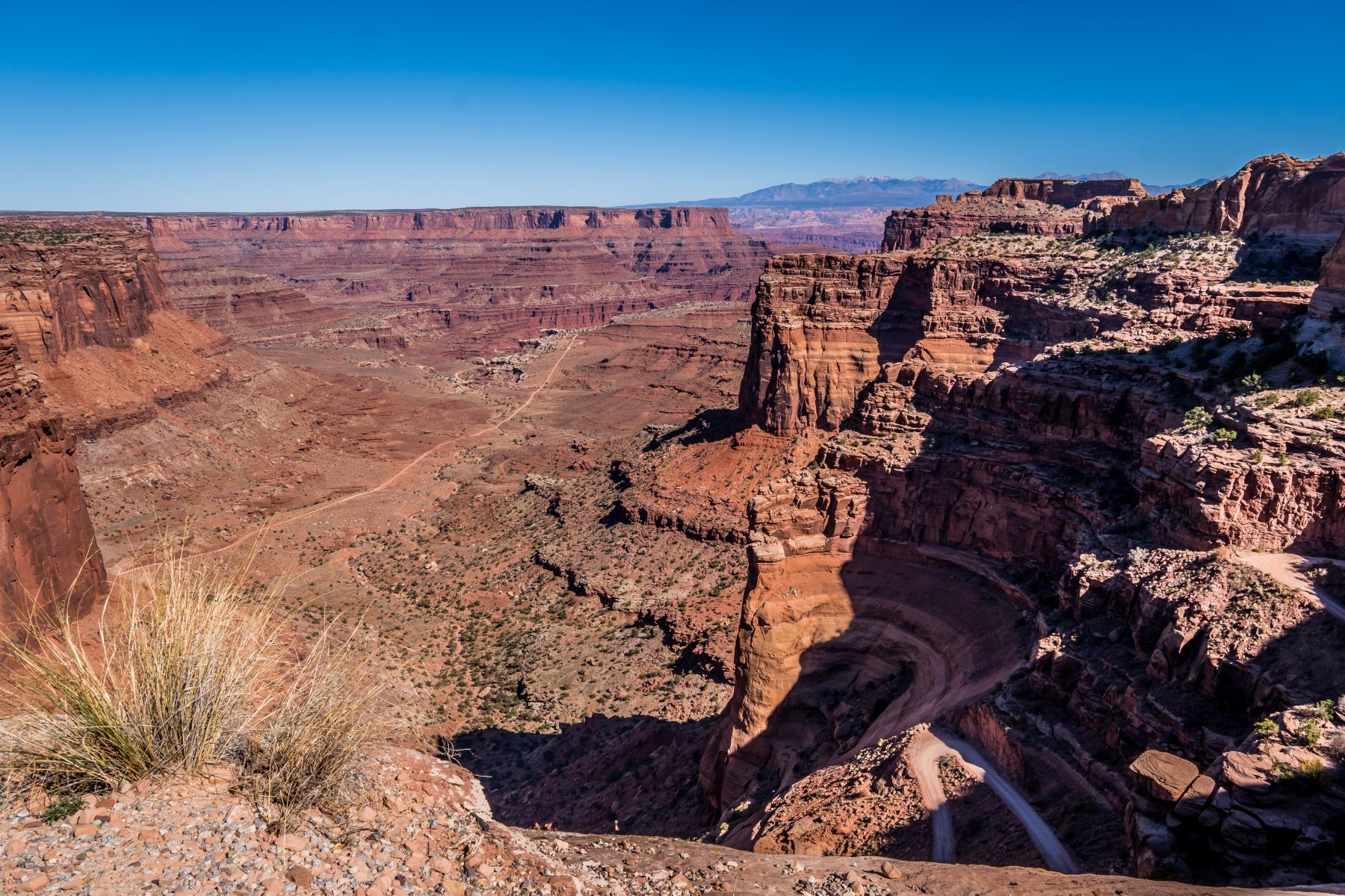
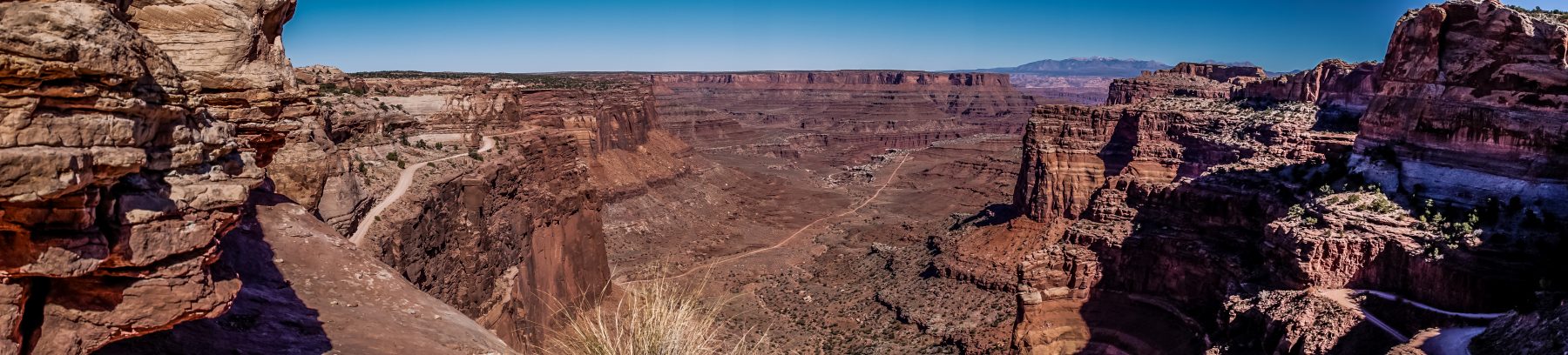
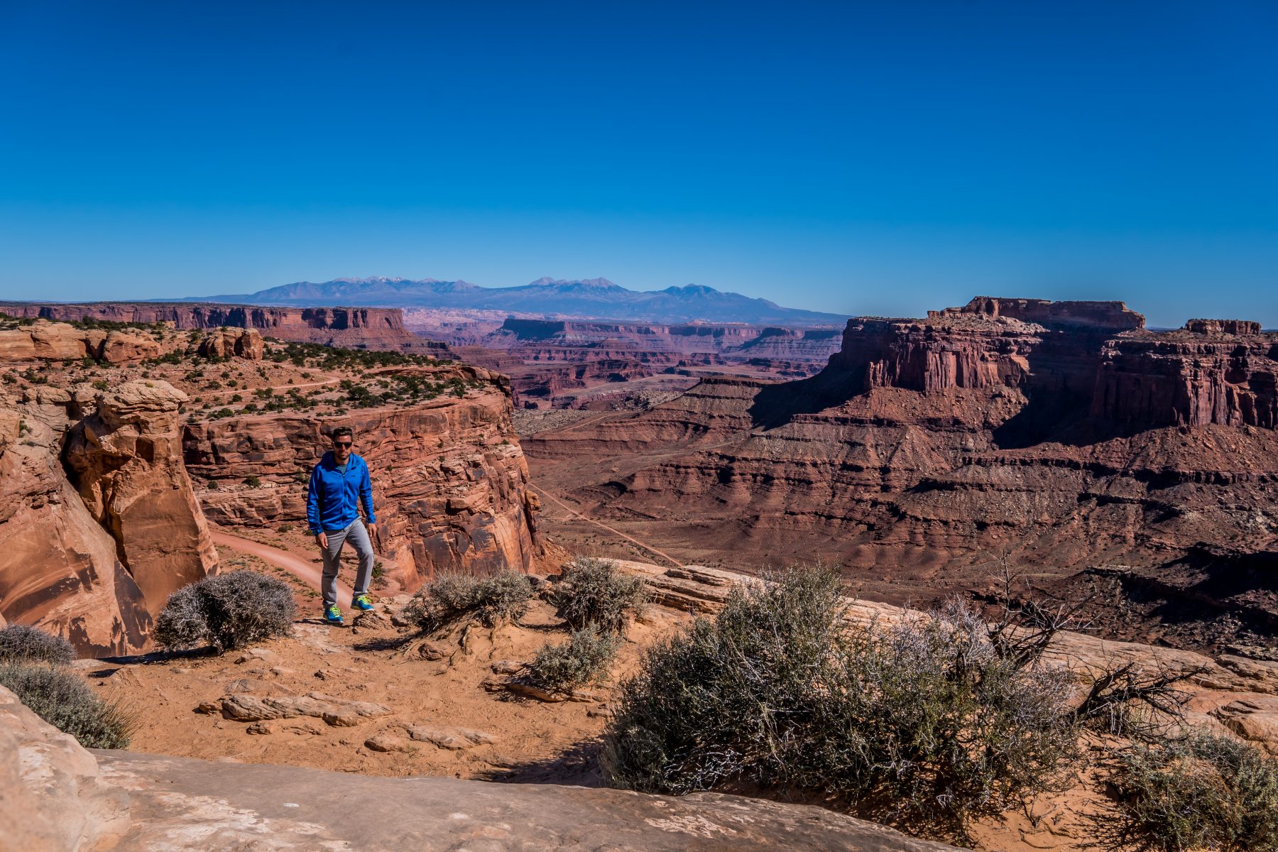
Shortly after you pass the evaporation pools, you cross a fence and find yourself at what feels like the top of the world. The road practically vanishes, and you are driving on a massive field of solid rock. An interesting sign about the Desert Big Horn Sheep and another about the Shafer Trail are posted at the start of the trail.
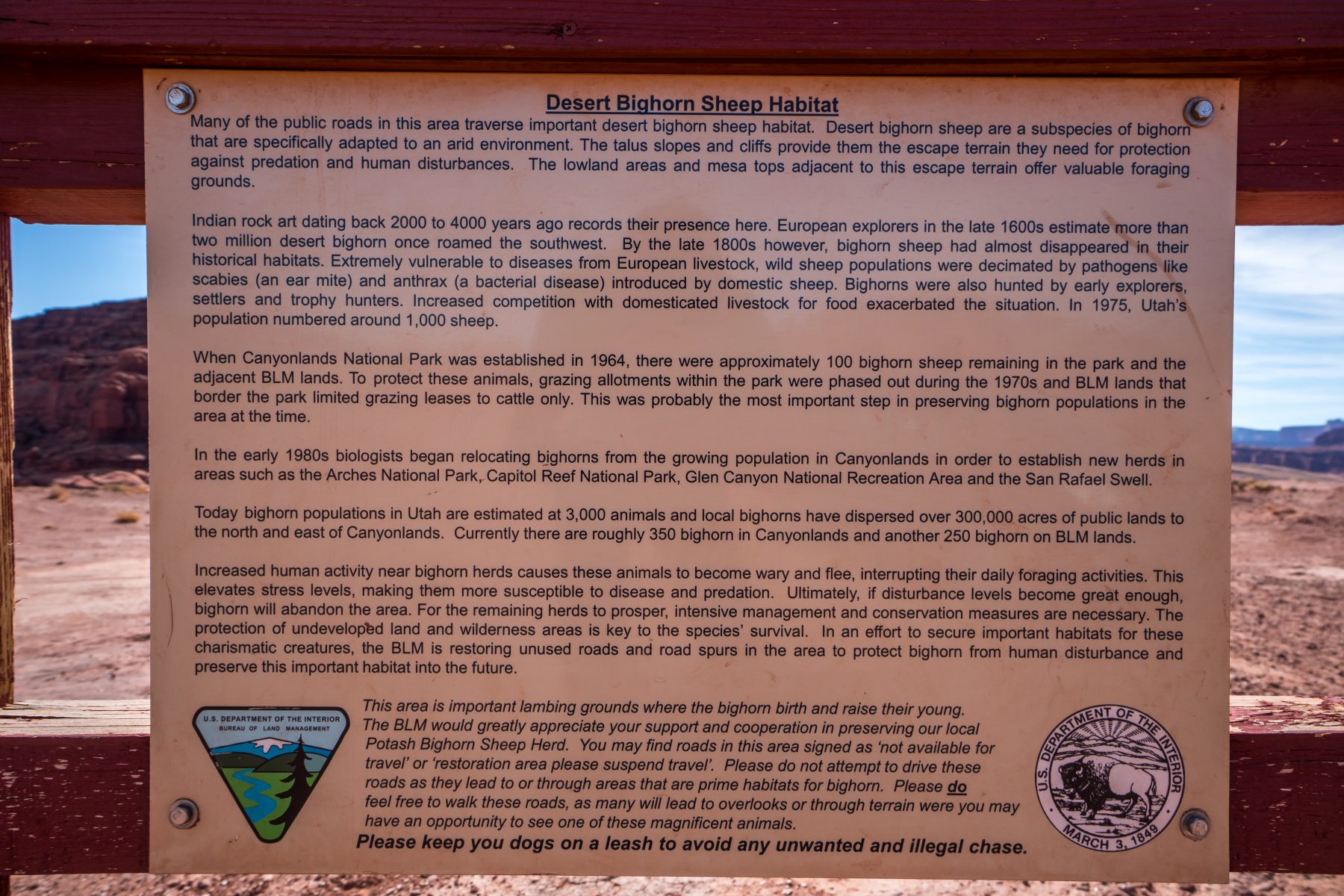
The sign about the Shafer Trail reads:
“The Potash Road accesses the Island in the Sky section of Canyonlands National Park via the Shafer Trail. The Shafer Trail uses several switchbacks to access the mesa top. Before it was a road, the Shafer Trail was a cattle trail. Following an old game trail, John Sog Shafer constructed a cattle trail around 1917. For years, the Shafer brothers wintered their cattle in Shafer Basin, and trailed them up the mesa top in the summer. In the early 1950’s, uranium exploration started in this part of the country.Uranium miners began looking for way to get their ore out from what is now the White Rim area of Canyonlands National Park. They decide that Shafer Trail was the most feasible route. The Shafer Trail road project was started in August 1952. The old cattle trail was turned into a truck route and was completed by October 1952. Ore from the White Rim area was trucked up the Shafer Trail and out towards Moab via the Dubinky Well Road. The Shafer Trail today serves as an entry into the National Park and to the White Rim Trail.”
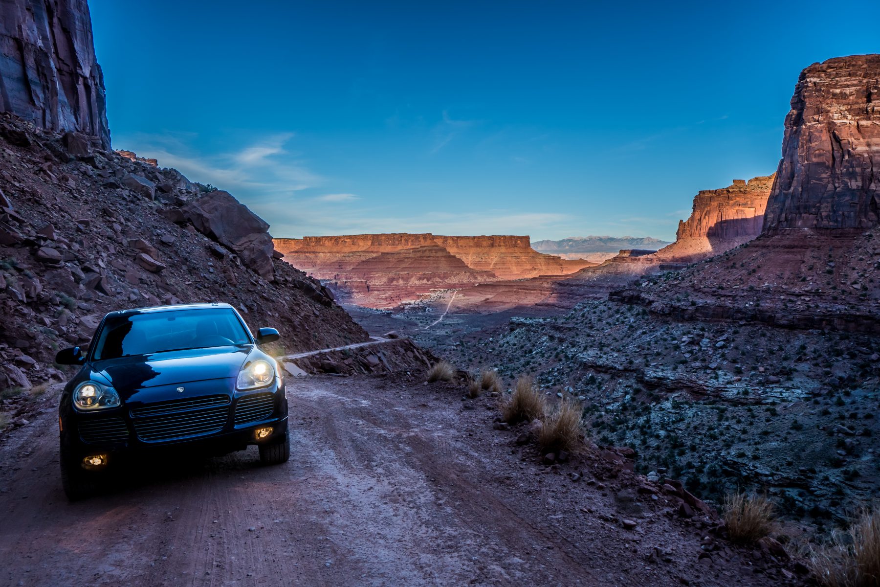
From this point forward, you exit the mine property and are driving on the Shafer Trail, through BLM land, until you reach Canyonlands National Park. When I started this journey, my plan was to see the evaporation pools; but once I got this far (it took nearly 2 hours with shooting photos), I decided that I’d just continue on to Canyonlands National Park, rather than go all the way back on the rough Potash Road that I came in on. I had no idea what I was in for!
Shafer Canyon Road is 19.4 miles of rather dangerous dirt road that requires extreme caution. The road is in poor condition and requires strong nerves to negotiate it. Not knowing where I was going, or how long the road even was, made the trip a bit more stressful; but now that I’ve done it, I’d do it again in a heartbeat!
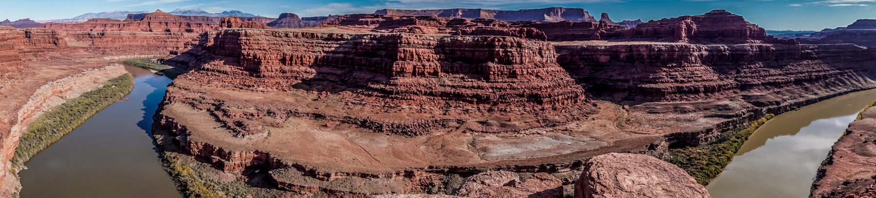
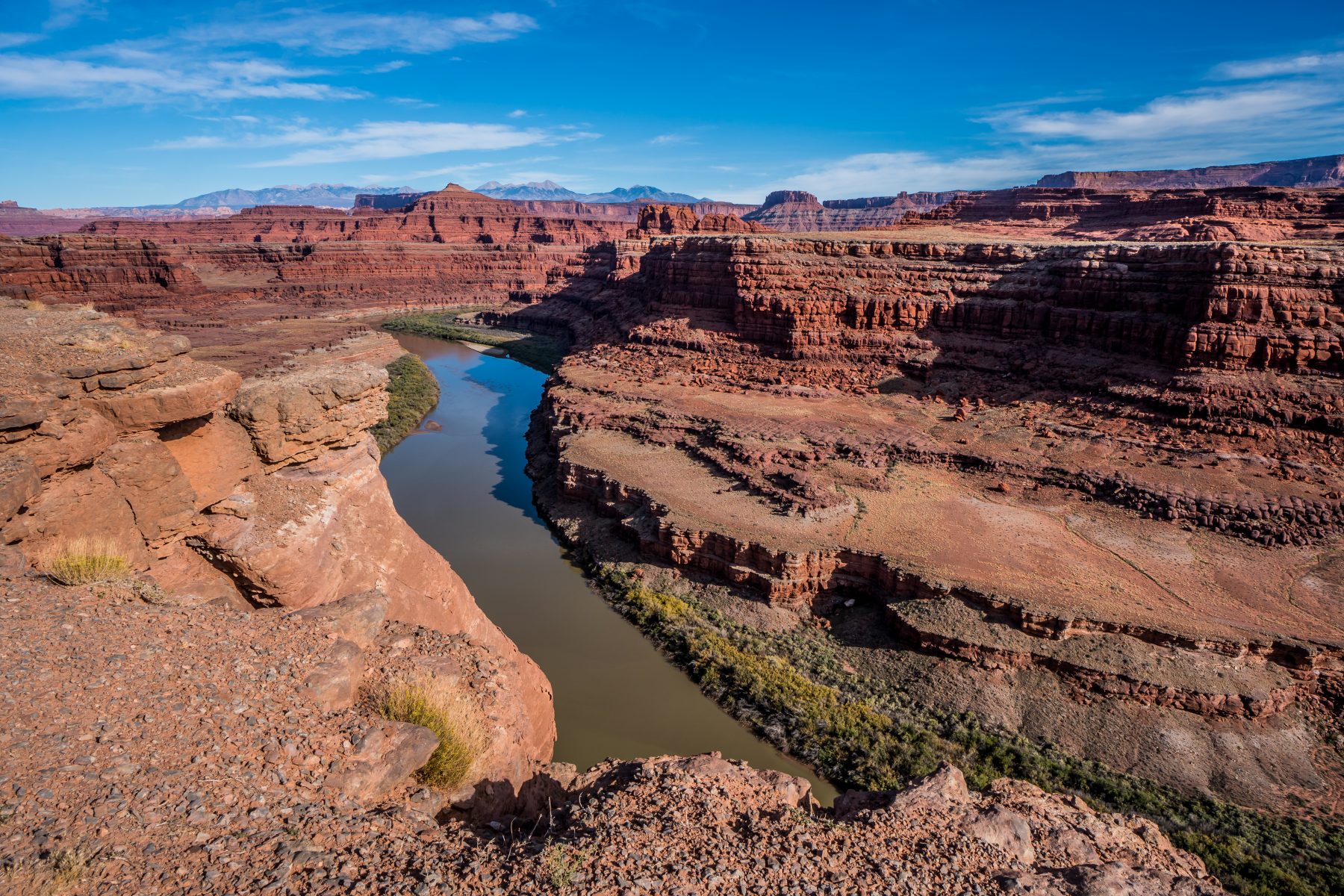
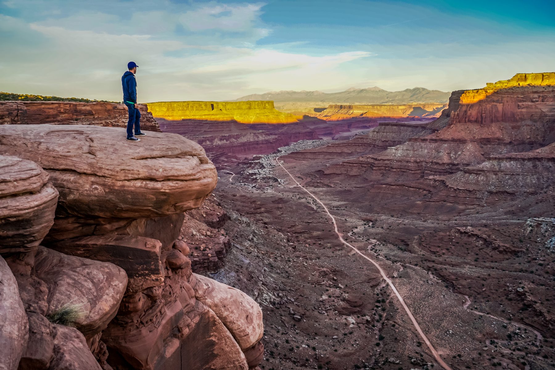
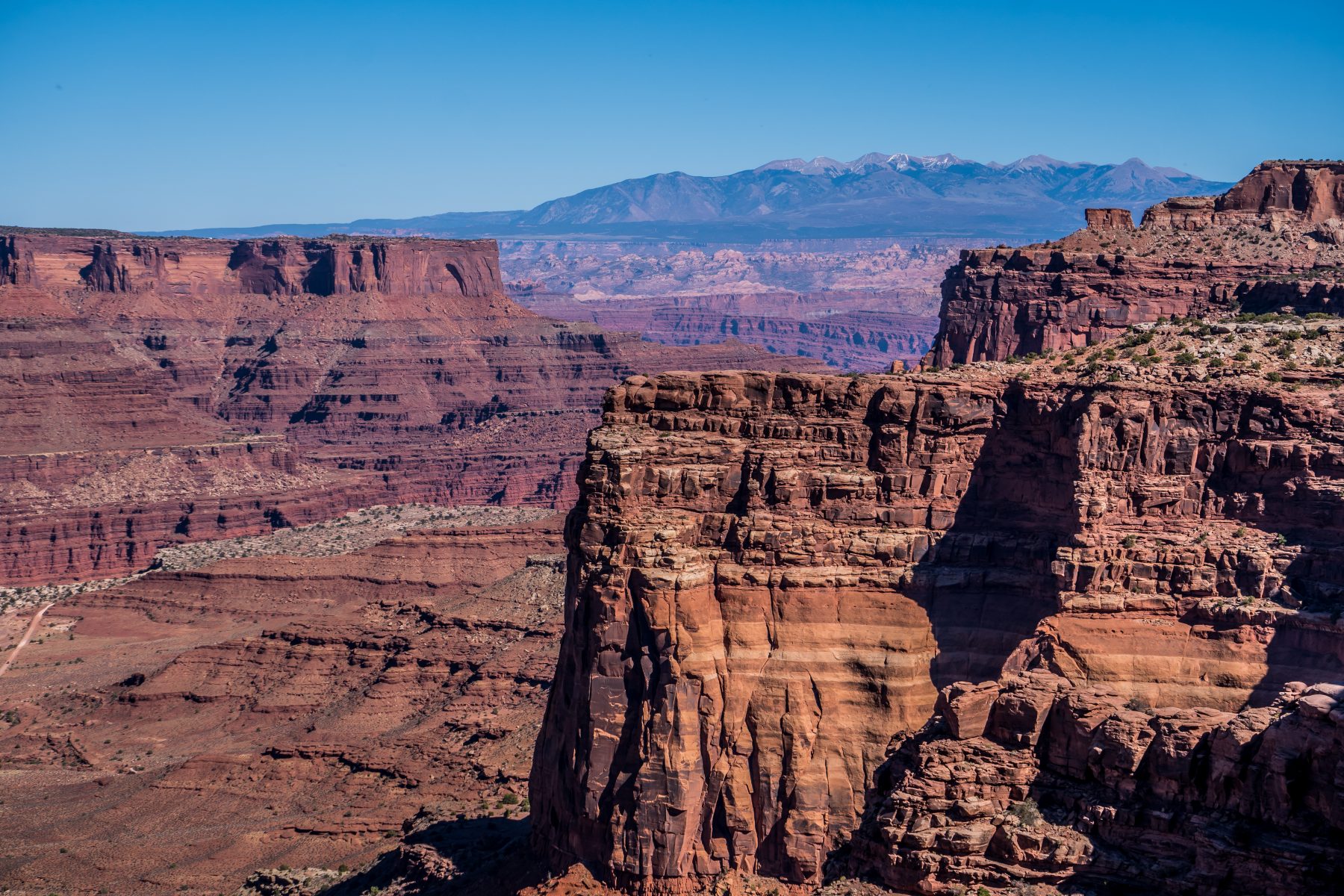
After 8 miles on the Shafer Trail (another 2 hours of driving), I found myself 2,000 feet above the Colorado River, at an absolutely stunning vista. I learned from one of the many Jeep tour guides that passed by me on the trail that this was the exact location that they filmed the ending scene in ‘Thelma & Louise’, and, it’s where they filmed much of my absolute favorite show, Westworld! I was pretty excited to learn this, on top of how excited I was at the views! Below is a slide show of my photos from this cliff, and the closing scene from the film. You can see clearly that this is the spot!
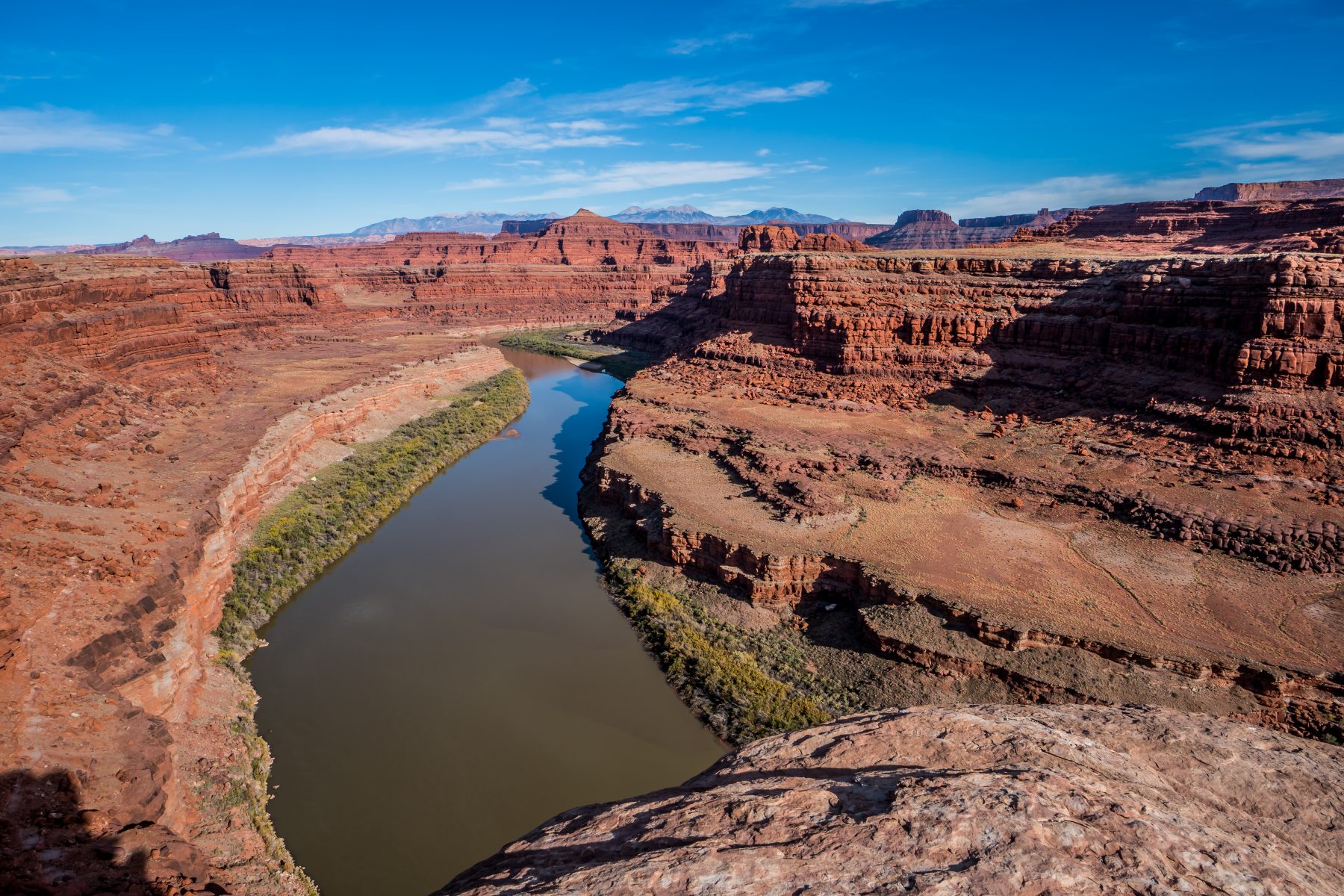
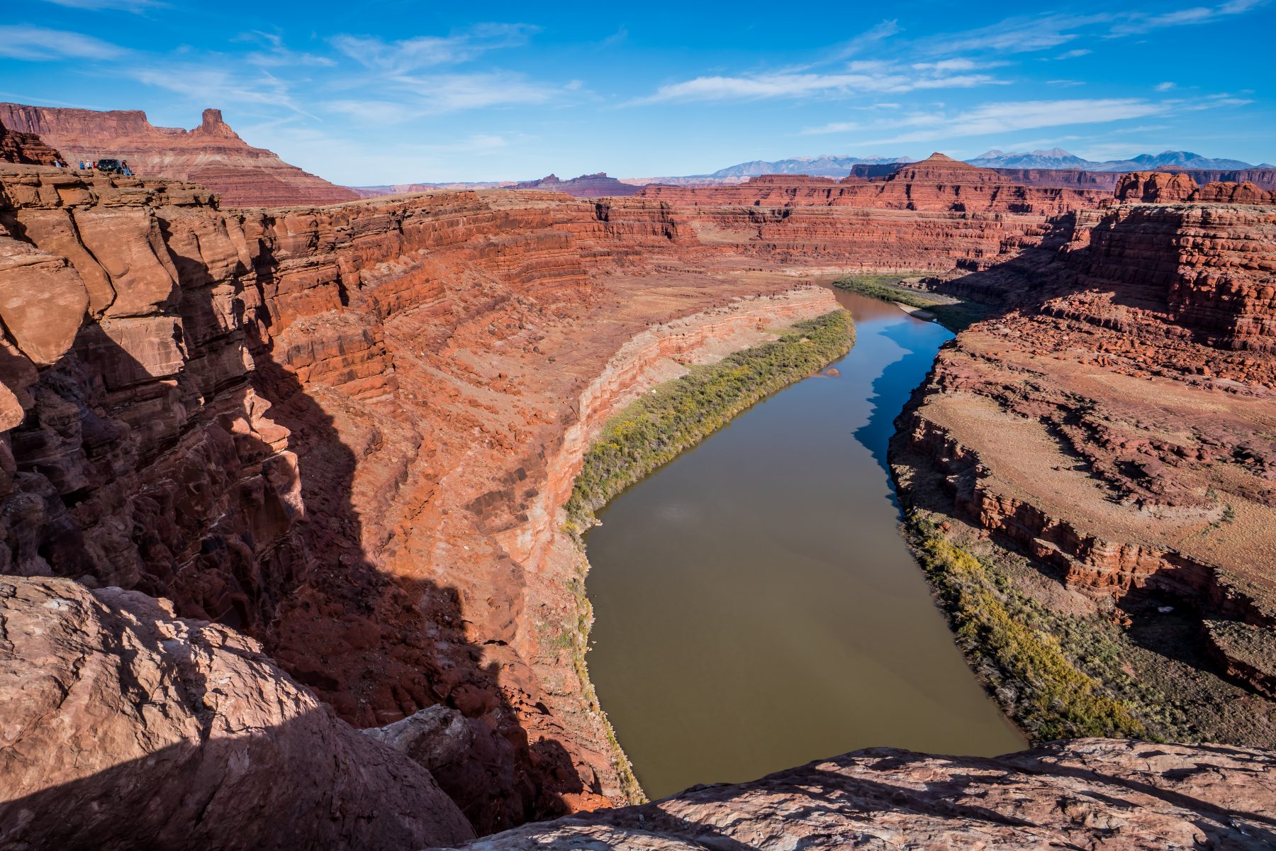
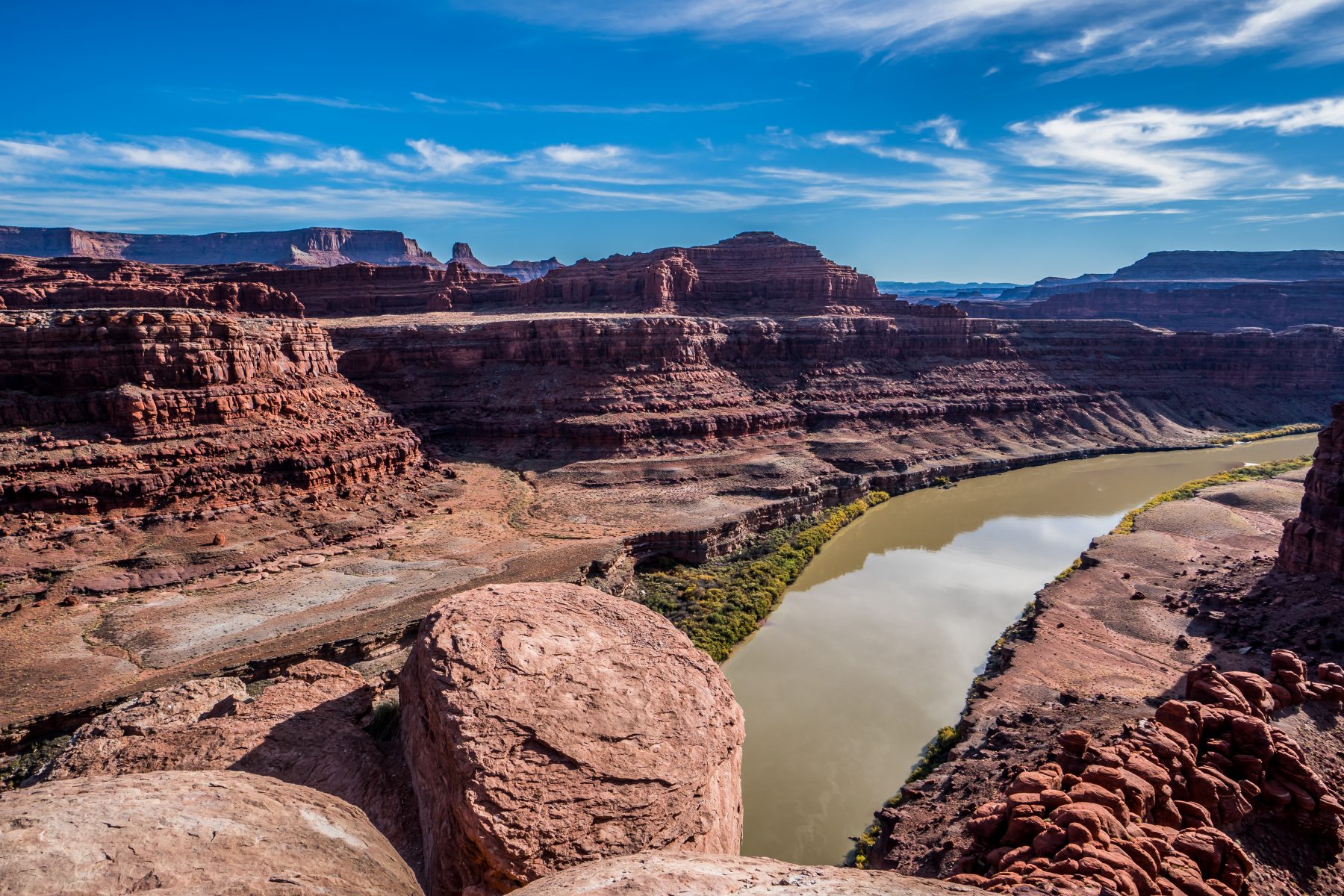
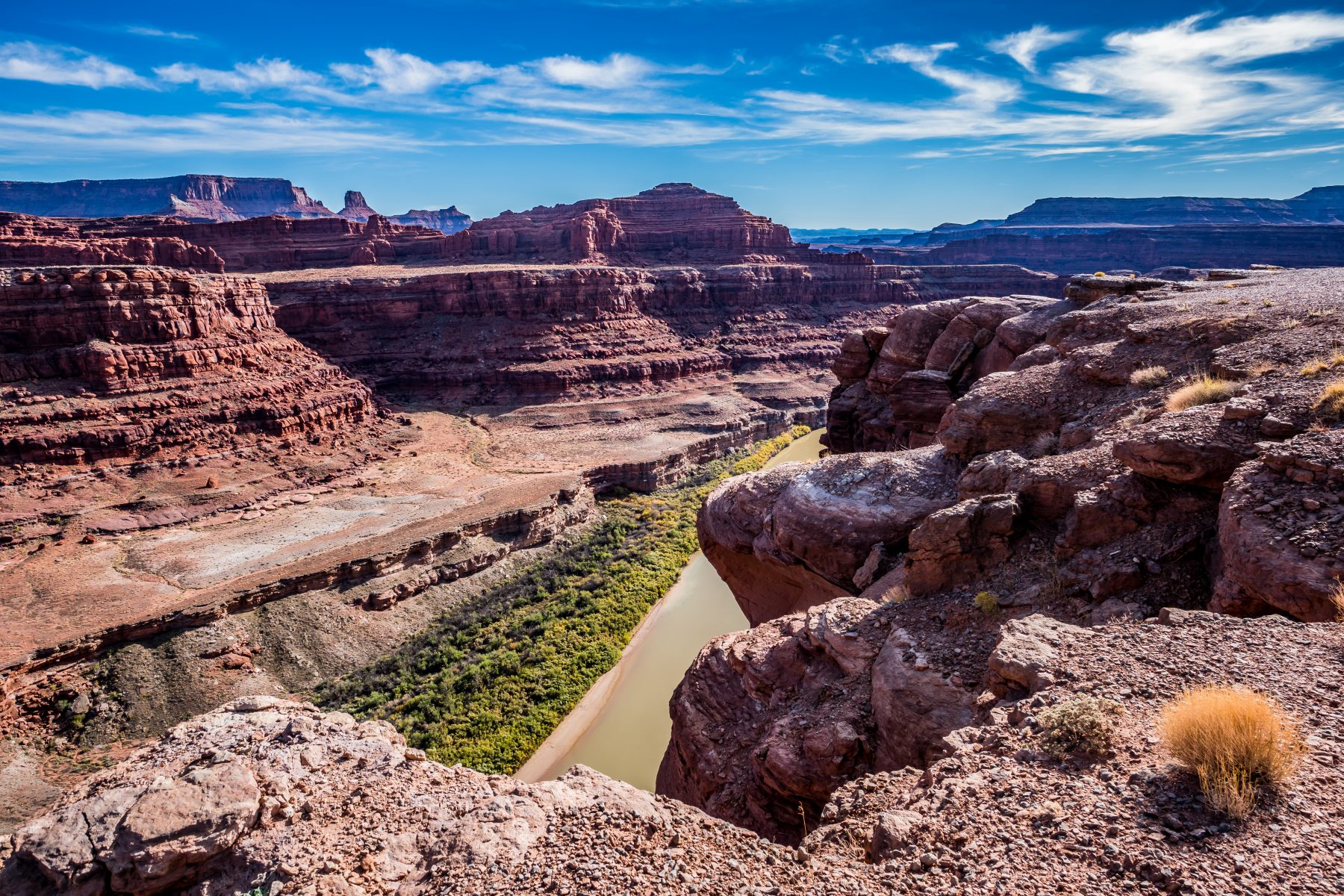
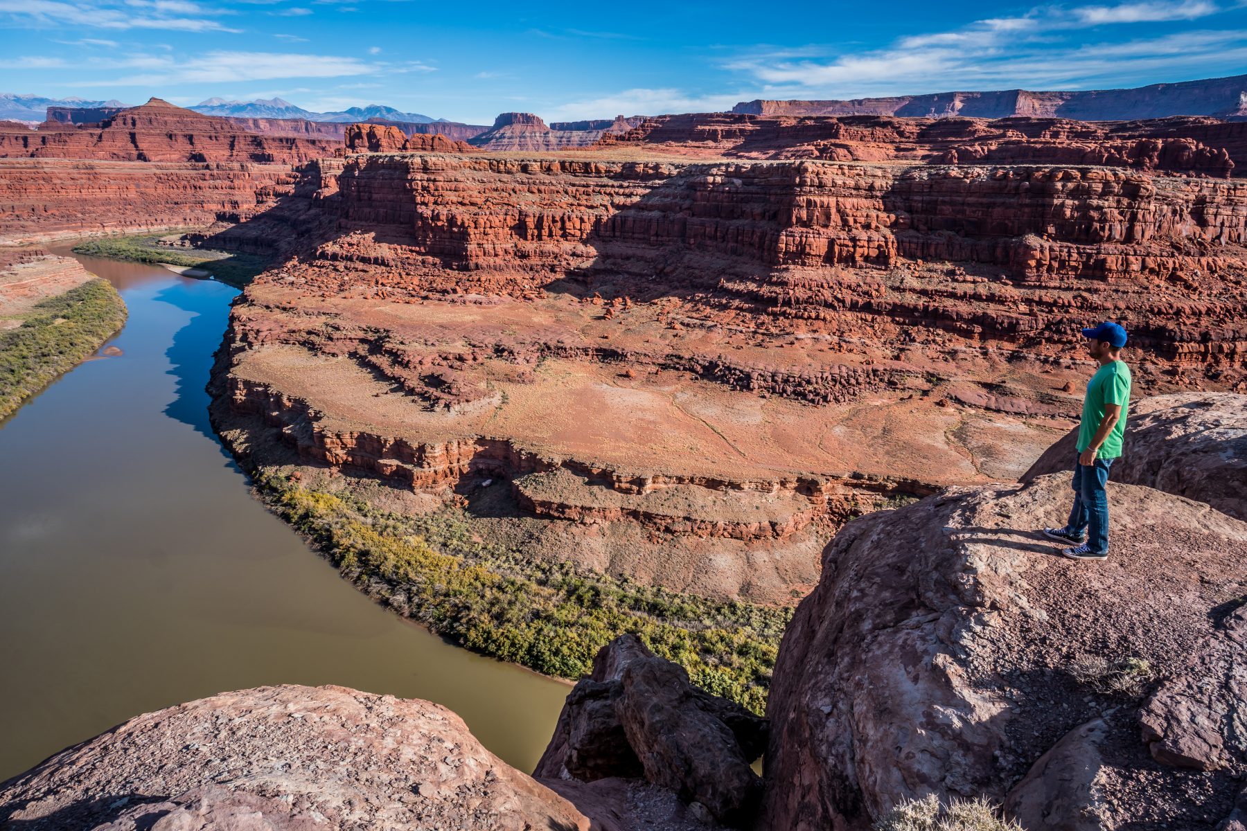
Another really amazing thing about this spot on the cliff above the river is that most of the rocks along the cliff edge are completely filled with seashell fossils. Most of the Western USA used to be covered by a massive inland sea, and the fossilized remains of the creatures that lived in it are everywhere around Utah and Colorado. I was easily able to find thousands of shell fossils throughout the rocks along this cliff, which just added to the excitement I had about this epic adventure.
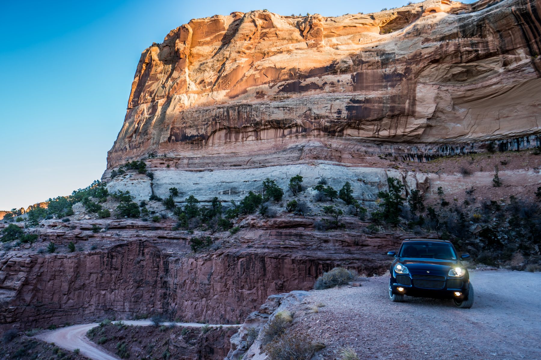
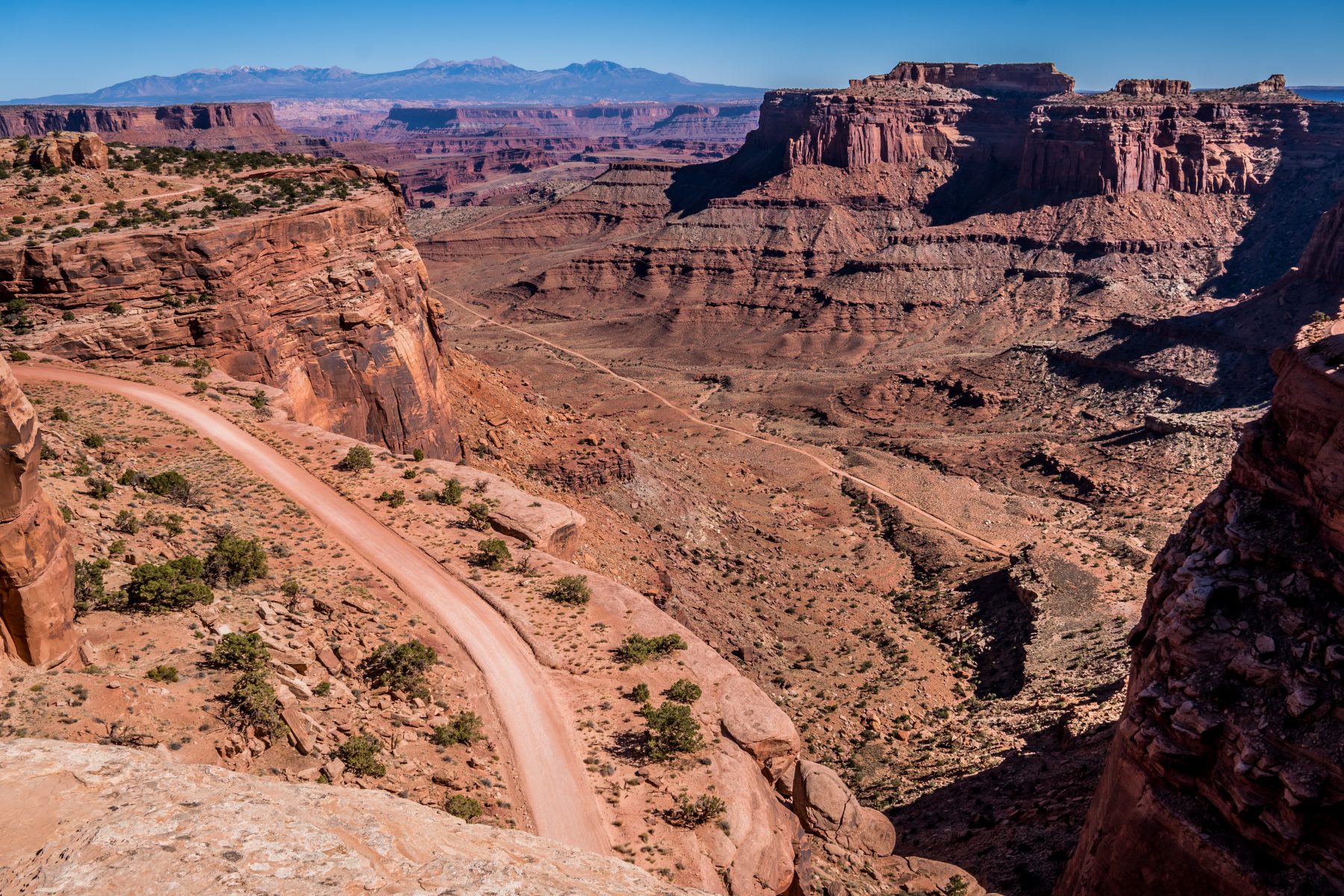
I departed the cliff around 4:00 because I wanted to make sure that I made it safely to the top of the Shafer Trail switchbacks before the sun set, as that is the most dangerous section of the trail. The switchbacks take you 2,000 feet up from the Shafer Valley floor, to the Canyonlands National Park visitor center at the top of the mesa.


Another 6 miles down the road and I finally reached the switchbacks. From below, looking up, they are daunting; but a week prior I’d seen them from above, and that’s even more overwhelming! If you have ANY fear of heights, you wouldn’t want to attempt this section of the drive, (or quite a few sections along the way here either!). The switchbacks are more than 5 miles long, and rise over 2,000 feet from the valley floor to the top of the mesa. Each turn is 180 degrees, and there are plenty of places where 2 cars can definitely not pass each other. Luckily, I only passed one other car, a very capable Toyota 4Runner, on the way up!


A few additional Photos of the Shafer Trail:
If you’d like to replicate this amazing adventure, here’s a map of the route beginning in Moab and ending at the Canyonlands National Park Visitor Center. Have fun!
For more of my adventures in Canyonlands National Park, check out my post: Upheaval Dome at Canyonlands National Park
Great blog! Do you need high clearance and 4WD for this route?
I did it in my Cayenne, as pictured, so you’d also be able to do it in any 4WD that doesn’t have high clearance I’d assume!